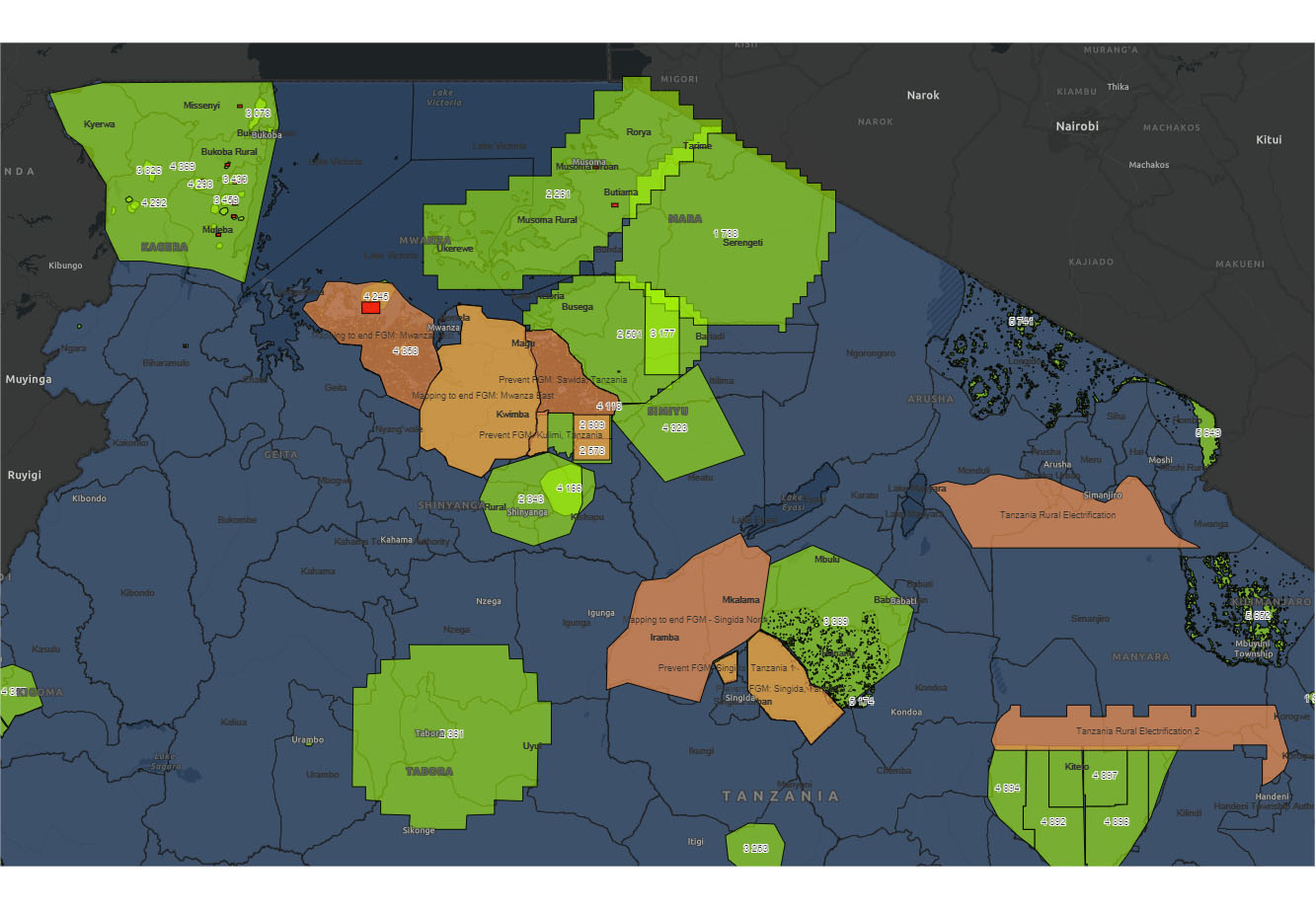
Blog

The Geospatial solutions

Missing villages

In recent years, we have managed to map millions of buildings which can help us determine the distribution of the population. In our latest project called Missing villages  – by using open-source government data about water sources in Tanzania – We’ve created a workflow that made it possible to give a name and delimit most…
Read more

Missing data

“In humanitarian catastrophes, data about the affected area is needed to increase the effectiveness of responses. Notably, spatial information about the distribution of population and the road network is critical for emergency management, and yet is missing for large portions of the world. The absence of information greatly limits the abilities of organisations to plan…
Read more

Querying OpenStreetMap with Amazon Athena

OpenStreetMap (OSM) is a free, editable map of the world, created and maintained by volunteers and available for use under an open license. Companies and non-profits like Mapbox, Foursquare, Mapzen, the World Bank, the American Red Cross and others use OSM to provide maps, directions, and geographic context to users around the world. As an…
Read more

Missing villages in Tanzania III – The plan

Facts:  The population in Tanzania was 44,929,000 in 2011/2012 (census data).  Tanzania 2020 population is estimated at 59,734,218 people at mid year according to UN data. Gates data was created by using satellite images of different vintages  This method is easy to implement for a smaller area (for example 500 km2). Better usable for urbanized…
Read more

Missing villages In Tanzania II

Scene 2 – Find the village Since the first part of our “Missing villages” project is already in the finish line, we have to explain the second part, which called “Find the village”. In the first phase, we tried to name the village, now we have to create the village boundaries, if possible. As we…
Read more

Missing villages In Tanzania

Knowing the vast, rural area of Tanzania is crucial to provide timely and effective help for girls during Female Genital Mutilation (FGM) ‘cutting seasons’. In recent years, we have managed to map millions of buildings which can help us determine the distribution of the population. Although low population density areas in Tanzania are not sufficiently…
Read more