“Each year, disasters around the world kill nearly 100,000 and affect or displace 200 million people. Many of the places where these disasters occur are literally ‘missing’ from any map and first responders lack the information to make valuable decisions regarding relief efforts. “
Missing Maps
Our goal is to fill this gap. Whether it be data collection or data analysis, map or dashboard.
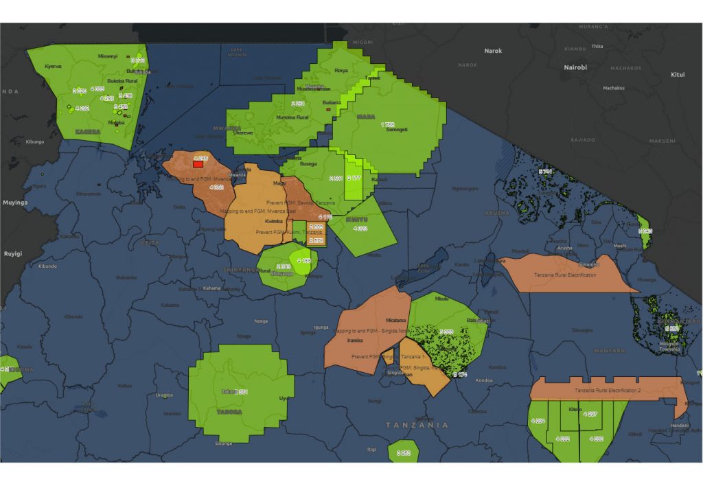
Crowd2map Tanzania GIS platform

Tanzania dashboard
A well-built platform can facilitate humanitarian organisation’s work. Organisations need an effective, comprehensive and system wide spatial data-sharing platform that contains, share and visualises existing datasets, cumulative data for reporting purposes and/or visualisation.

Routing machine
Leaflet Routing Machine is an easy, flexible and extensible way to add routing to a Leaflet map. Using the default is just a few lines of code to add fully functional routing, but you can still customize almost every aspect of the user interface and interactions.
Tanzania dashboard (ArcGIS)
Side project for a conference -data visualisation about running and closed projects running on the HOT OSM tasking manager, or on MapSwipe application.

Remote volunteers’ contribution – dashboard
The database shows the number of contributions with the #tanzaniadevelopmenttrust hashtag. You can sort by number of contributions or you can sort users in alphabetical order and/or you can use filter to find an OSM user.
Other works

Fertility rate analysis
Analysing of the social change – in time – is not easy. Analysis of social differences at a fixed point in time is much easier to implement. This social differences can be dividing up the linguistic, national, or religious, and many more perspective.

Simple dashboard – map & charts
This test dashboard can show how the Leaflet, dc and D3 can work together.
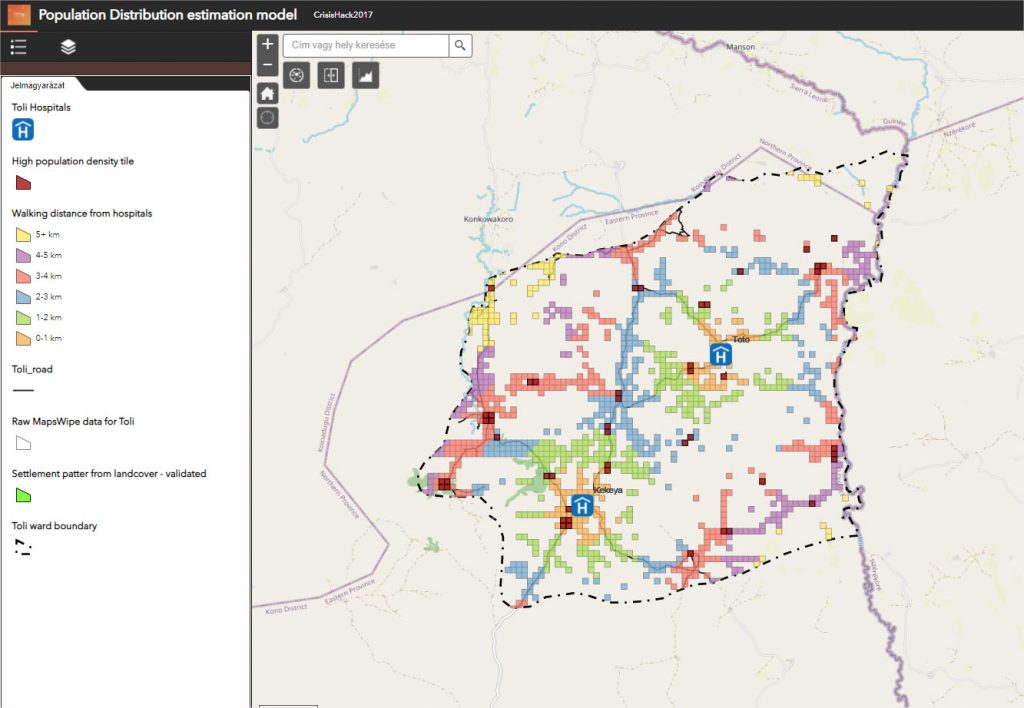
CrisisHack 2017 – Population Distribution estimation model – Sierra Leone
Unique ways to get high resolution population distribution data sets for a particular area in Africa. High population density areas are demarcated by settlement extents provided by processing Landsat images, while low population density areas are demarcated using the MapSwipe smartphone application and volunteer-generated data are used to determine the spatial extent of the inhabited areas.